Gunnaikurnai Country
Four weeks to the day after having my hip replaced and four months later than originally planned, we set off to travel up the East Coast. We learned from my cousin Trish and her husband Dion that, in their haste to get to the well known bits of the coast, many people inadvertently miss out one of the most beautiful and environmentally precious regions of Victoria. Sometimes referred to as The Far East, the southeasterly corner of the state up to the boarder with New South Wales, known as East Gippsland, is land stolen from the Gunaikurnai people and most of it looks the way the whole of Victoria would have appeared prior to colonisation.
GuanoKurnia Country - Emerald Link
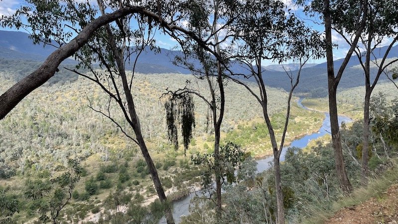
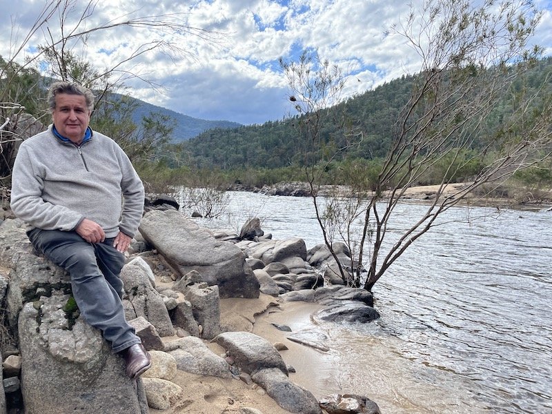
The Emerald Link stretches from snowy alpine peaks to the shores of untouched coastlines, these forests form the only continuous tract of vegetation from mountain to coast that remains on mainland Australia. It represents just nine percent of Victoria yet is home to 709 listed threatened species, approximately one third of all Victoria’s threatened species. Additionally, of the 190 Rainforest Sites of Significance across the state, 120 are in East Gippsland. This makes the region extremely important as a sanctuary for their survival. Taking Trish and Dion’s advice, we planned a route to include the Snowy Mountain National Park and Mallacoota over on the Southeast Coast and, on the way, we planned to visit the block of land my niece Nicola and husband, Vlad, had recently purchased at Metung.
We’d briefly been to Metung before when we met the father of the chap buying our first Troopy but at the time we didn’t know that Nic and Vlad were planning to build there. As we always like a site visit, we offered to take a look at their block and share our thoughts on what they could build there. We found the steeply sloping site with a spectacular view over the eastern end of Lake King and could understand that when they first saw the view, they knew they wanted to live there. We set up on the flat spot at the top of the site which was just big enough for the Troopy with the awning out. After sitting out looking at the mill-pond-Like lake till after dark we tucked up looking forward to our travels ahead.


Just before dawn, we were woken by the noise of rain and the awning flapping in strong winds. With visions of losing the canvas or, worse, breaking the awning frame, we scrambled outside in our night clothes and bare feet to ensure that didn’t happen. I’m sure holding onto a guy rope slipping around in the mud wasn’t on the list of hip rehab exercises but thankfully we packed the awning away without injury or damage and noted that it was easier to clean and dry skin than clothes so maybe naked camping is the way ahead!
A particular recommendation from Trish and Dion was to visit McKillop’s Bridge, a 255m steel and concrete structure with a timber deck which crosses the Snowy River just after its confluence with the Deddick River. Constructed in 1936, it represented an extraordinary engineering feat at the time of construction and replaced a lower bridge that washed away in a flash flood the day before it was due to be officially opened. It was built primarily to allow cattle and sheep to be safely herded across the notoriously unpredictable Snowy River. In fact the bridge was tested with a herd of 700 cattle as it wasn’t possible to get a steam roller or similar heavy test vehicle up to the bridge.
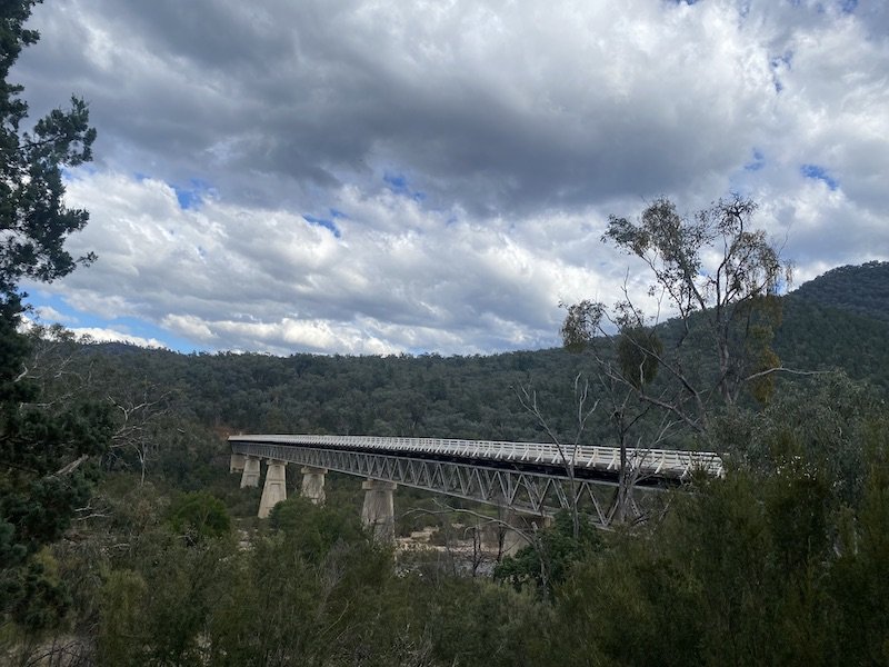
McKillop’s Bridge, East Gippsland, Victoria
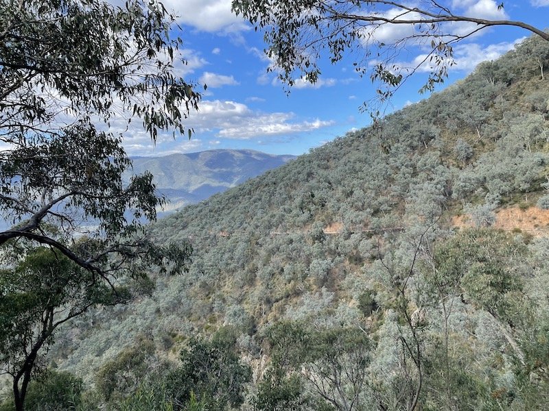
Even today, McKillop’s Road is listed as one of Australia’s most hazardous roads but, as the Troopy is listed as one of the most capable off-road vehicles, we felt it would be good to put the two together. This tortuous single dirt track is cut into the steep hillside and is frequently blocked by fallen rocks and trees or washed out by heavy rain. There are few passing spots and no barrier between the soft road edge and the drop to the river valley far below but the view is great!
The Snowy River from McKillop’s Rd as it approaches the bridge from the west
You can just see McKillop’s Rd cutting through the trees on the opposite hill side
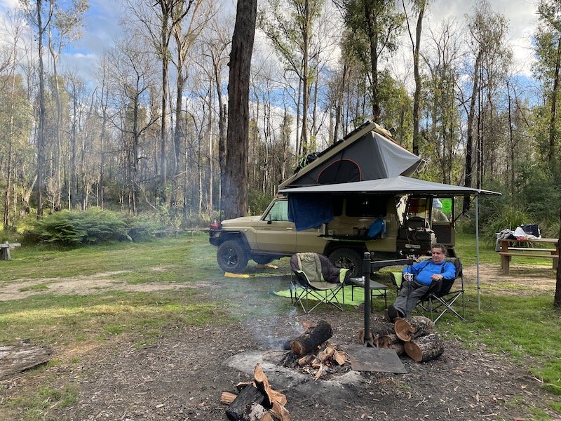
As the light was fading we set up on a free campground in the bush just before the bridge, a favourite of people spending time on the water. Arriving at a camp late in the day makes picking a spot a bit risky and, when Ian felt biting on his ankles, we realised we’d parked on a huge ants nest! Needless to say we weren’t staying there and moved on a little further. The river level was low so the following morning we wandered along the edge of the water on what is often the river bed thinking about what life may have been like for the Aboriginal people and the early European settlers who lived and traded on this country.
View over the Emerald Link


The minimalist wooden deck of McKillop’s Bridge
The road on the other side continues to hug the contours of the hills beside the Deddick River but is a little wider allowing larger vehicles to reach the the bridge. Before the road turned southwards on the eastern side of the Snowy River National Park, we came across another historic structure, the Ambyne Suspension Bridge. Opened in 1935 it is considered historically and scientifically significant as a unique surviving example of a bridge built by the Victoria’s Country Roads Board (CRB). At that time, the CRB were committed to providing basic traffic routes to ensure that Ambyne pastoral settler’s produce could be transported to distant ports and markets thus keeping them on their bush plots. Life was extremely hard for the pioneer settlers; they chose to clear dense forest and attempted to farm animals and crops unsuited to the harsh conditions and most of the original settlers eventually walked off their land.
The bridge is one of only two surviving suspension bridges built for this purpose and used a modified pedestrian bridge design allowing trucks with a gross weight of only three tons to cross. It was constructed using salvaged timber from the deck of the earlier McKillop’s bridge washed away in the flood and components from a temporary bridge on the Princes Highway at Orbost.
In 1970, a new bridge was built to manage heavier loads and the original one fell into disrepair until a restoration project started by local people was supported by State and National funding. Much of the structure visible today is original and has been restored and preserved with components only being replaced if absolutely necessary.

Ambyne Suspension Bridge, East Gippsland, Victoria
As the hills gave way to the valley floor, we were delighted by these two spectacular deciduous trees clothed in full autumn colour; jewel-like surrounded by the muted dress of the eucalypts. After stopping the night at Goongerall campground, another free camp with a brilliant entry sign, we headed back down to join Route A1, the road that circles the whole continent and set a course for Mallacoota.


In 2019, temperatures in Australia were some of the hottest on record and this was preceded by two years of similarly hot, dry conditions. The entire country was a tinder box and many fires were spreading rabidly through forests and towns giving rise to the name The Black Summer. On New Year’s Eve, a catastrophic bushfire in East Gippsland almost obliterated the small town of Mallacoota. As the ferocious fire swept through the surrounding bush and into the town, four thousand people were evacuated to the foreshore. Protected by a single line of fire trucks operated by largely volunteer teams of firefighters, residents waited poised to jump into the water if ordered to do so. Reports described how day turned to night with the thick smoke and that a cheer went up when the wind changed direction moving the fire away from their refuge.

Mallacoota (Credit for image: Matthew Abbott, New York Times)
As the Country burned, the right wing government of the day, lead by Scott Morrison, refused to discuss the man-made climate emergency that was contributing to the causes of such fires and accused the Green party, climate scientists and activists of alarmism. Since these fires, nothing has been done to reduce CO2 emissions and fossil fuel production has increased in Australia. Calls for a national plan and resources to protect people and property from bushfires by the group Fireproof Australia have landed protesters and firefighters in jail as politicians clamp down on the messengers rather than listening to the message.
Although the Black Summer fires destroyed over two thirds of the precious forest in East Gippsland and killed thousands of creatures, the Victorian state-owned logging company, VicForests, continues to log key refuge areas that are essential habitats for remaining and displaced animals. This destructive business, which reports heavy financial losses despite being subsidised by the Victorian government, is regulated by the very organisation that runs it. Even with High Court injunctions in place illegal logging and destruction of habitat continues which requires constant vigilance and intervention by environmental protectors to physically stop the activity.
The ongoing battle to protect these forests is supported by multiple environmental groups, charities and communities working together. The Goongerah Environment Centre Office (GECO) has campaigned since 1993 for ancient forests under threat from logging using education, public awareness campaigns, political lobbying, non-violent direct action, citizen science and forest monitoring. Based in the small town of Goongerah in far East Gippsland, many people working with GECO lost their homes and livelihoods in the 2019 fire but, despite the draconian new laws designed to curtail protests, a mass meeting at GECO recently endorsed state-wide action to protect forests. We are thankful this is happening and, if we lived here, would be participating too.
Having read about the fires and watched the ABC Back Roads show which illustrates how the little community of Mallacoota is working to rebuild the fabric of life, we wondered what we would find. Residents on the show explained how upset they were by ‘disaster tourism’ where people cruised around the town sipping coffee, gawping at the devastation and posting their phots on Facebook. Due to the fortunate change of wind direction, parts of the town, including the campground on the foreshore, were untouched by the flames so we chose to stick to those areas and support the businesses in the area.
The resident population is only around 1,300 but this can rise to 8,000 in the summer which explained the vast foreshore campground. As we were there in early May, we were one of maybe a dozen rigs so we not only had a prime waterside spot but it was peaceful and teaming with birdlife, a far cry from when the evacuees were gathered there. We had lovely weather with sun and short showers which made a rainbow every day.


Mallacoota sits near the mouth of the Wallagaraugh River which is more of a lagoon at that point due to a large sand bar creating a limited exit for the water to reach the sea. The sand is constantly shifting with the tides and is also affected by long shore drift (quick flashback to O-level Geography) which periodically blocks the exit all together. When this happens, the water level in the lagoon rises up to two meters, flooding the camp spots where we were, until the water pressure eventually blows a hole in the sand bar and levels return to normal. We learned that there are many such openings along the coast and, as some inlets are more commercially important than others, a few are constantly dredged or even blasted with explosives to keep them clear.

The sand bar is on the horizon
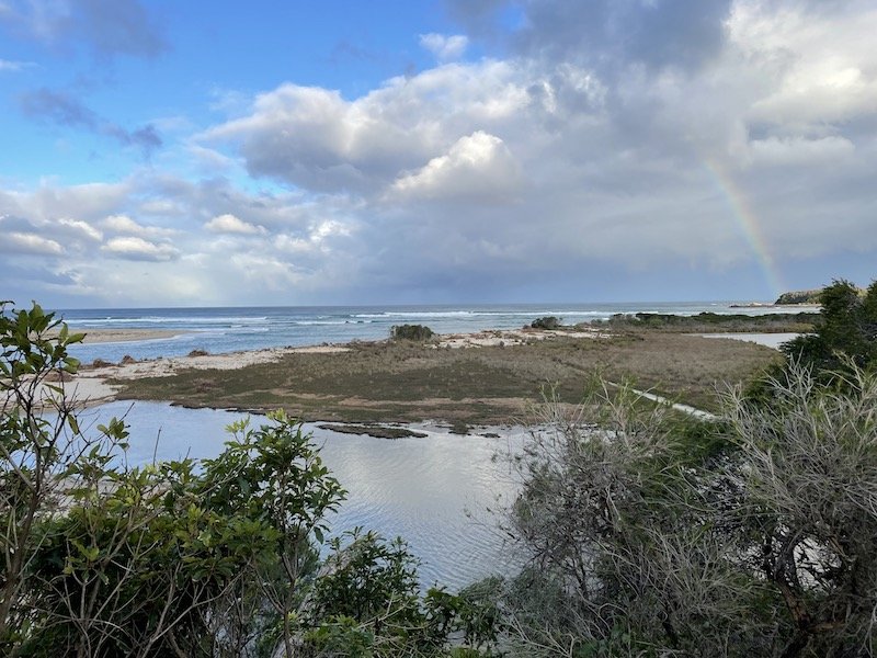
The opening to the sea
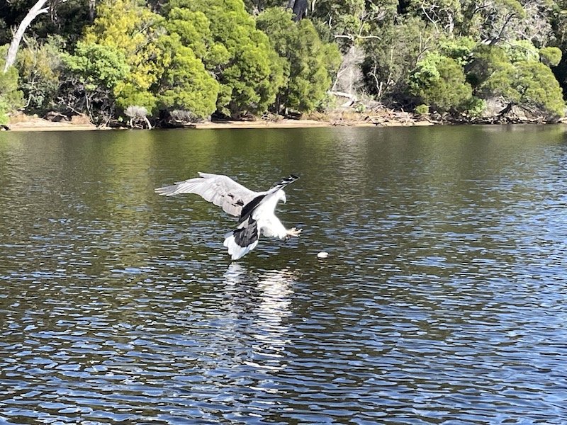
On our last day, we went on a boat trip around the lagoon with Mallacoota Cruises & Eco Tours which was the highlight of our stay. The little boat, the M.V Loch-Ard, was built in Melbourne in 1910 from Tasmanian Huon Pine and Kauri which is considered some of the best wood in the world for ship building. The skipper, Colin, was really knowledgeable about the area and, as a former abalone diver, had plenty of stories of life under the ocean. He pointed out many birds who made their homes on the shoreline including this fabulous White Bellied Sea Eagle who was perhaps a bit too used to performing for a scrap of chicken wing.


The M.V. Loch-Ard
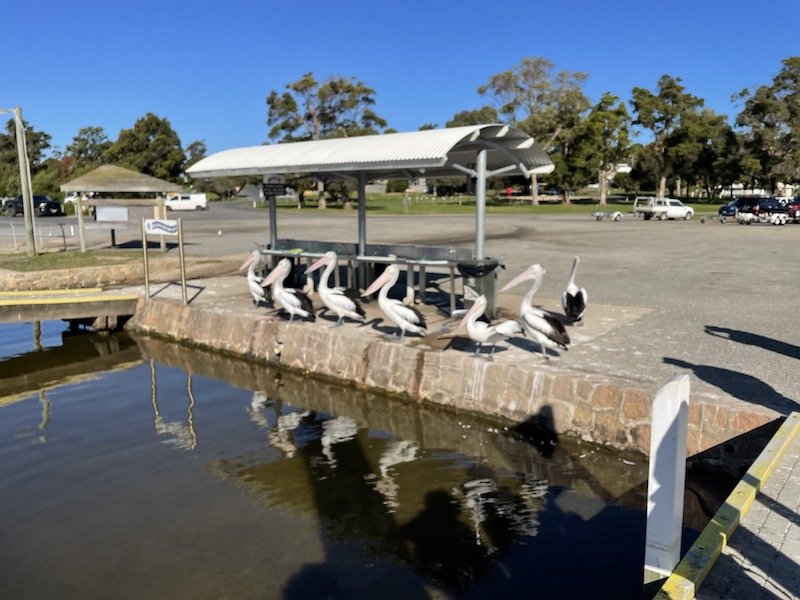
Our welcoming party at the end of the trip
Join us next time as we cross the boarder into New South Wales and head up the East Coast.